Nr. 30/11 m
 Show digital copies
Complete identifier
NLA HA, Kartensammlung, Nr. 30/11 m
Item description
Identification
Title
Title
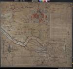
Karte der Elbe im Gebiet zwischen Hamburg und Lüneburg (mit Überschwemmungsgebieten, Deichen sowie Stadtansichten und Wappenzeichnungen)
Life span
Life span
1569
Former identifier
Former identifier
I C a 1
Provenance
Partial provenance
Partial provenance
Übersichtskarten
Information / Notes
Additional information
Additional information
vgl. auch NLA HA Kartensammlung Nr. 30/9 m
Additions
Classification PartB
Classification PartB
elbe
Information on manufacturer
Author
Author
Zeichner: Franz Buch; Martin Bokol
Further information (picture)
Format
Format
122,5 x 135 cm
Number of sheets
Number of sheets
1
Scale
Scale
ca. 1:35.000 - 1:40.000
Representations
| Type | Name | Access | Information | Action |
|---|---|---|---|---|
| Original | Karte | 0099 / 6 | Show details page | |
| Masterdigitalisat | Multimedia | Show details page | ||
| Nutzungsdigitalisat | Multimedia | Show details page |